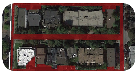
Mapping:
Mapping is a great way to identify issues and resources in your neighbourhood by helping you think in a bigger picture. There are also many things you can map on your block.
Assignment:
Method 1: Gather several colorful markers and satellite photos of your block/yard to map on (you can print them on regular paper instead of photo paper. Recommended size: 11" by 17" or 18" by 24").
Method 2: Map on Google Maps below
What is Habitat Mapping?
There are many different habitats(other than human habitat) on your block.
Here are
are some examples of different habitats that you can map in this exercise

1. "Squirrel Habitat" - Trees & Canopy
Now that you have an idea of how safe it is for squirrels on your block after the Urban Forest Quest, examine all the trees on your neighbourhood map and figure out how much canopy cover you have. Urban tree canopies have many important benefits, such as lowering temperatures and reducing store effects.

30% of total area is squirrel habitat
2. "Worm Habitat" - Lawns & Soil
These soft surfaces allow water to pass into the ground, reducing the flooding and amount of contaminants entering streams all at once. Soil provides important habitat for many types of underground creatures, and space for trees, plants, and fungi to grow.

35% of total area is worm habitat
3. "Car Habitat" - Hard Pavement
Pavement is an impervious surface, which forces stormwater into sewers or pipes rather than into the soil. This can result in chemicals from the road entering streams and heavy water flow damaging stream banks. Roads and parking lots also take up a lot of space and increase temperatures.

20% of total area is car habitat
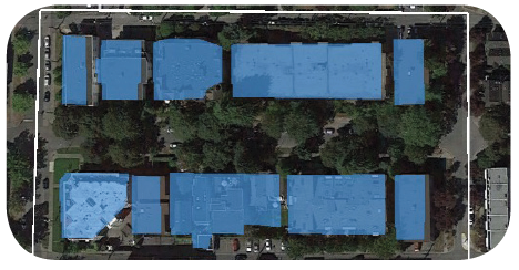
4. "Pigeon Habitat" - Buildings & Roofs
These hard surfaces also effect storm water drainage, often directing rainwater straight into the drains and not to the plants which need it during droughts. Roofs can also provide space for solar panels or green roof installation, which can help mitigate and adapt to the effects of climate change.

45% of total area is pigeon habitat

